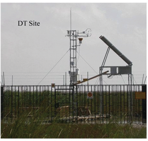
Wetlands may have a small global footprint, but provide several important services including improving water quality, and providing flood protection and erosion control. In recent years, they have become increasingly recognized for their strong ability to sequester carbon. Despite covering only six to nine percent of the Earth’s surface, it is estimated that they store upwards of 35% of terrestrial carbon.
Whether an ecosystem (such as a wetland) is a carbon source or a carbon sink is determined by its net ecosystem carbon exchange (NEE). Accurate estimates of NEE in turn require accurate estimates of Gross Primary Production (GPP), which is a measure of how much carbon is fixed in plants during photosynthesis –the main pathway for transport of carbon from the atmosphere to the land. GPP can be measured directly in the field. However, these direct measurements are both financially costly and time-consuming.
A promising approach to estimate GPP that overcomes these hurdles uses empirical modeling to correlate GPP with related biogeophysical parameters derived from remote sensing data. These biogeophysical data can be much easier to obtain than field measurements of GPP, especially if the data are available for free, as is the case with data from the Moderate Resolution Imaging Spectroradiometer (MODIS), an instrument onboard two NASA satellites.

Data derived from instruments such as MODIS that are useful for estimating GPP and NEE include land surface temperatures and vegetation indices. These indices describe the health or density of vegetation. Numerous studies have been conducted to estimate the GPP of ecosystems such as forests, croplands and grasslands using remote sensing data. A recent study by Wu and co-workers, from the Chinese Academy of Sciences, is one of the few studies to focus on the GPP of wetlands.
For an estuarine wetland in eastern China, the authors extracted various biogeophysical parameters from MODIS data, and correlated these parameters with field-measured GPP. When validating their model, the authors found that they were able to estimate the GPP of their study site with a high degree of accuracy. However, they caution that their model cannot simply be taken as-is and applied to different climates and ecosystems.
As the authors demonstrate, certain relationships in the model can vary from one ecosystem to another. For example, the relationship that uses land surface temperatures and vegetation indices to estimate light use efficiency, a measure of carbon fixation via photosynthesis, will be different for a boreal forest relative to an estuarine wetland. As yet, the model has only been validated for one particular wetland across several 8-day periods. Thus, the model still needs to be tested on other wetlands and other ecosystem types to evaluate its performance within and across ecosystem types.
Despite the relative newness of this model, its performance so far combined with the free availability, high temporal resolution, and wide spatial coverage of the MODIS data it requires mean it shows great potential for simplifying the way in which we estimate an ecosystem’s ability to sequester carbon.
To access the full article and read more about using satellite data to “see” how well wetlands take up carbon, download a copy for free* by clicking the link below.
Combining remote sensing and eddy covariance data to monitor the gross primary production of an estuarine wetland ecosystem in East China
Mingquan Wu, Shakir Muhammad, Fang Chen, Zheng Niu and Changyao Wang
Environ. Sci.: Processes Impacts, 2015, 17, 753-7625
DOI: 10.1039/C5EM00061K
—————-

About the webwriter
Abha Parajulee is a Ph.D. student at the University of Toronto Scarborough. She is interested in water resources and the behavior of organic contaminants in urban environments.
—————-
* Access is free until 24/07/2015 through a registered RSC account.


